
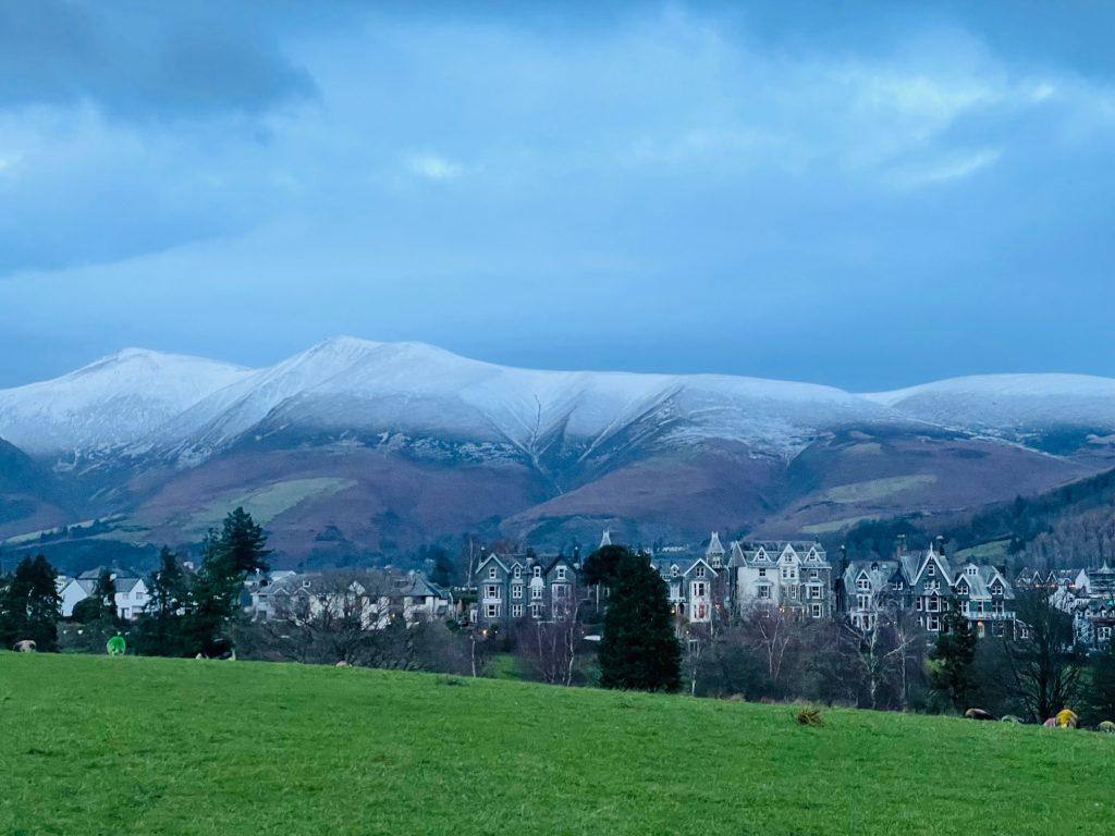
Skiddaw from Keswick
Skiddaw is a huge sleeping beast hulking over the town of Keswick. With a summit of 931m, it’s England’s sixth highest mountain, with numerous routes both ascending and descending the massif.
I’ve done Skiddaw three times, and always in bad weather, so I’ve yet to see the view from the top, but it’s such an adventure that it’s a trail I’ll do again and again. While the initial ascent is quite steep, it’s actually the most strenuous part of this route, so once you’re up it, it’s pretty plain sailing to the trig point at the summit.
While there’s a small parking lot near the base of Jenkin Hill (see parking note below), it’s worth walking from Keswick itself, taking in a lovely woodland stroll along the base of Latrigg before heading up and onto Skiddaw itself. Starting from Briar Rigg on the edge of Keswick, we walk along the Cumbria Way up Mallen Dodd toward the Jenkin Hill. Don’t let the name “Hill” mislead you; this is by far the steepest part of the walk, but offers fabulous views back over Keswick and Derwent Water, so don’t forget to look behind you as you ascend!
Once you’re at the top, simply follow the pathway, passing through a couple of gates along the way, as you head to the summit. Please note that the entire area surrounding the summit is quite rocky, and some of the rocks are quite sharp, so walk carefully, especially in wet conditions.
Parking: Park and walk from Keswick (using one of the town’s parking lots, which are well signposted in the town), or alternatively use the small parking lot located at postcode CA12 4PH (note however that this lot fills quickly, so be sure to get there early for a spot).
Toilets: None outside of town
Cautions: This trail up Skiddaw isn’t a technical route, but it is quite a strenuous one due to the altitude gained, and the length of the route. The weather can also change very rapidly on this fell, so always be prepared with waterproofs and warm clothing. The top of the massif has a lot of scree, so please be careful and watch your footing, especially near the summit. I’d also recommend a walking pole if you’ve got any dodgy knees or ankles, as the descent back down Jenkin Hill can be quite hard on your joints. This is definitely a route that requires sturdy walking boots.
Download the Skiddaw from Keswick route gpx file (right click and choose Save As)
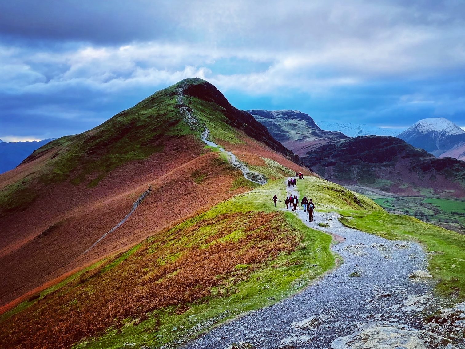
Catbells from Keswick
Anyone who has visited Keswick or Derwent Water will have seen Catbells, an exceptionally attractive fell rising from along the water’s western shore. As such, it’s an extremely popular fell for walkers, with visitors year round, and a walk I’d highly recommend to anyone visiting the area for the first time. While the summit is only 451m, its prominence gives it some of the best views of the area.
Most people walking up Catbells take the ferry to Hawes End and walk from there, or park at the small lot near Skelgill (details below). My route takes the Cumbria Way from Keswick town centre and continues after Catbells up to Bull Crag, which offers fantastic views across to the west.
This isn’t a circular route; the best route is to return entirely along the initial route, or to return to waypoint 8, taking the path down Hause Gate and continuing back either along the lower marked path or the road itself to Keswick.
Parking: Park in Keswick town centre (recommended), the pay parking lot at Fawe Park (postcode CA12 5TZ) or the small parking lot near Skelgill (postcode CA12 5UE). Alternatively, you can take the Derwent Water ferry to Hawes End.
Toilets: No public toilets outside of Keswick. There are customer toilets at The Lingholm Kitchen along this downloadable route.
Cautions: Catbells is a relatively straightward ascent and walk, but please do note that there are two sections where you need to scramble up rocks. While there do appear to be paths to either side of these rocky sections, they’re not really usable.
Download the Catbells and Bull Crag route gpx file (right click and choose Save As)

